


Rushmere Voting District, Isle of Wight County, Virginia
About
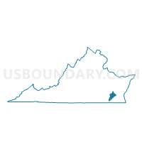
Outline

Summary
| Unique Area Identifier | 681966 |
| Name | Rushmere Voting District |
| County | Isle of Wight County |
| State | Virginia |
| Area (square miles) | 52.04 |
| Land Area (square miles) | 26.27 |
| Water Area (square miles) | 25.76 |
| % of Land Area | 50.49 |
| % of Water Area | 49.51 |
| Latitude of the Internal Point | 37.06739860 |
| Longtitude of the Internal Point | -76.67080760 |
Maps


Graphs
Select a template below for downloading or customizing gragh for Rushmere Voting District, Isle of Wight County, Virginia


Neighbors
Neighoring Voting District (by Name) Neighboring Voting District on the Map
- Bacon's Castle Voting District, Surry County, VA
- Carrollton Voting District, Isle of Wight County, VA
- Deep Creek Voting District, Newport News city, VA
- Lee Hall Voting District, Newport News city, VA
- Pons Voting District, Isle of Wight County, VA
- Riverside Voting District, Newport News city, VA
- Roberts B Voting District, James City County, VA
- Smithfield Voting District, Isle of Wight County, VA
- Warwick Voting District, Newport News city, VA
Top 10 Neighboring County Subdivision (by Population) Neighboring County Subdivision on the Map
- Newport News city, Newport News city, VA (180,719)
- Roberts district, James City County, VA (10,361)
- Newport district, Isle of Wight County, VA (8,284)
- Smithfield district, Isle of Wight County, VA (7,753)
- Hardy district, Isle of Wight County, VA (6,470)
- Bacons Castle district, Surry County, VA (1,443)
Top 10 Neighboring Place (by Population) Neighboring Place on the Map
Top 10 Neighboring Unified School District (by Population) Neighboring Unified School District on the Map
- Newport News City Public Schools, VA (180,719)
- James City County Public Schools, VA (67,009)
- Isle of Wight County Public Schools, VA (35,270)
- Surry County Public Schools, VA (7,058)
Top 10 Neighboring State Legislative District Lower Chamber (by Population) Neighboring State Legislative District Lower Chamber on the Map
- State House District 64, VA (83,940)
- State House District 93, VA (73,204)
- State House District 94, VA (71,464)
Top 10 Neighboring State Legislative District Upper Chamber (by Population) Neighboring State Legislative District Upper Chamber on the Map
- State Senate District 3, VA (211,723)
- State Senate District 13, VA (197,229)
- State Senate District 1, VA (170,275)
Top 10 Neighboring 111th Congressional District (by Population) Neighboring 111th Congressional District on the Map
Top 10 Neighboring Census Tract (by Population) Neighboring Census Tract on the Map
- Census Tract 2801.03, Isle of Wight County, VA (6,690)
- Census Tract 315, Newport News city, VA (5,843)
- Census Tract 323, Newport News city, VA (5,720)
- Census Tract 2801.04, Isle of Wight County, VA (4,454)
- Census Tract 2801.05, Isle of Wight County, VA (4,036)
- Census Tract 801.02, James City County, VA (4,014)
- Census Tract 2801.01, Isle of Wight County, VA (4,007)
- Census Tract 318, Newport News city, VA (3,960)
- Census Tract 8602, Surry County, VA (3,651)
- Census Tract 8601, Surry County, VA (3,407)
Top 10 Neighboring 5-Digit ZIP Code Tabulation Area (by Population) Neighboring 5-Digit ZIP Code Tabulation Area on the Map
- 23185, VA (46,370)
- 23606, VA (29,283)
- 23601, VA (25,127)
- 23430, VA (17,281)
- 23314, VA (6,991)
- 23883, VA (2,551)
- 23304, VA (71)